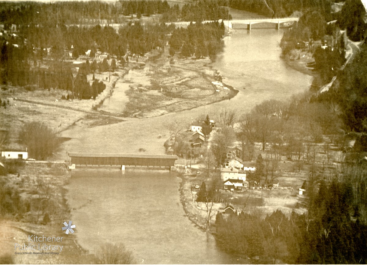
A black and white photograph showing an aerial view of the flooding at West Montrose, Ontario in May 1974. The West Montrose covered bridge can be seen in the foreground, while the Line 86 Road bridge can be seen upriver in the top right.
A black and white photograph showing an aerial view of the flooding at West Montrose, Ontario in May 1974. The West Montrose covered bridge can be seen in the foreground, while the Line 86 Road bridge can be seen upriver in the top right.
Copyrighted: Protected by copyright. Uses other than research or private study require the permission of the rightsholder(s). Responsibility for obtaining permissions and for any use rests exclusively with the user
Reproductions
If you would like to obtain a digital or print copy of this image, please see KPL's Photographic Reproduction Policy at http://www.kpl.org/localhistory/photographs